


Map Multi-Tool
Map Multi-Tool
Regular price
$19.95 USD
Regular price
Sale price
$19.95 USD
Unit price
per
Shipping calculated at checkout.
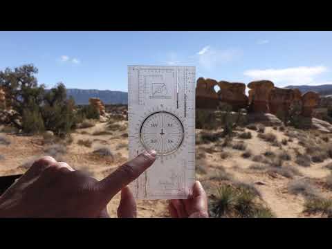
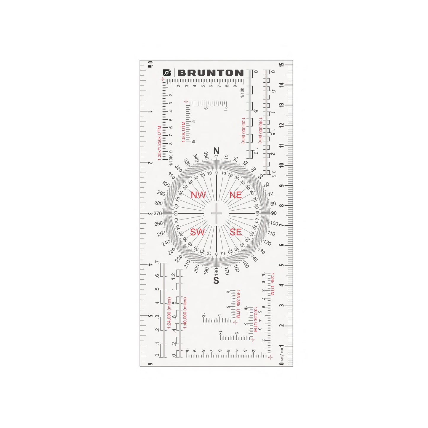
Designed during a boring meeting! The Brunton Map Multi-Tool combines rulers, map scales, UTM grids, and protractors all into one handy tool. It features a unique protractor for measuring or plotting angles on maps and a unique strike and dip crosshairs cutout in the center. The rulers are in inches and centimeters, and the map scales and UTM grids are in several common international map scales. Unique cutouts make it easier to plot points or lines on maps. The Map Multi-Tool easily fits into field pouches, vest pockets, or field notebooks for safe storage when not in use.
Map Multi-Tool Product Manual and Videos
Couldn't load pickup availability


Details for Map Multi-Tool
FEATURES
TECH SPECS
TESTIMONIALS